Home » Natural Resources » Shell Lake-Yellow River Farmer-Led Watershed Council
Shell Lake-Yellow River Farmer-Led Watershed Council
OUR MISSION:
Working as a non-profit organization to improve soil health and water quality through outreach, education, and conservation practices that improve sustainable agriculture.
WHERE IS THE WATERSHED?
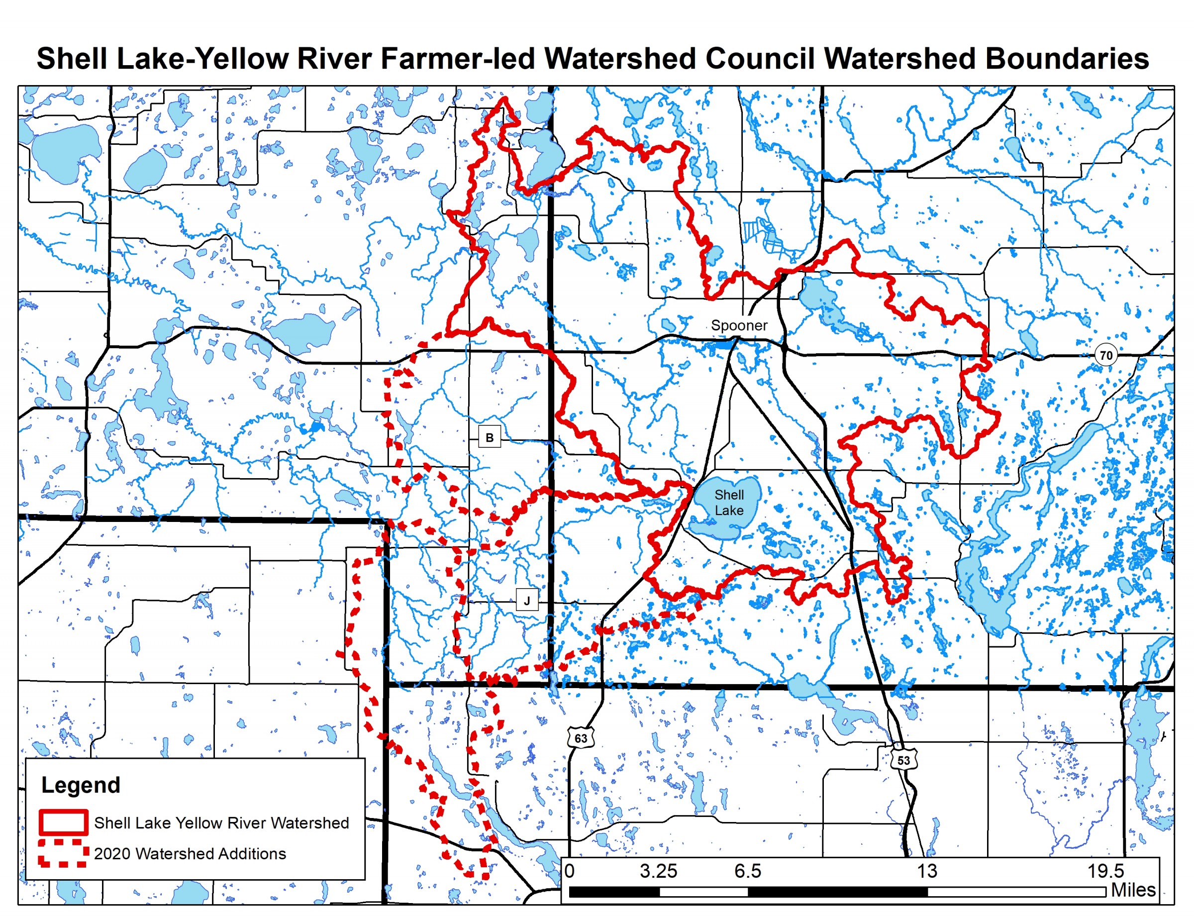
The Shell Lake-Yellow River watershed encompasses Spooner Lake and the headwaters of the Yellow River in the north, goes south around Shell Lake, and goes as far west as the Yellow River crossing at County Hwy H in Burnett County. Within this watershed are 63 lakes, 14 streams, and abundant groundwater. In 2020, three smaller watershed were added: Bashaw Brook, Sand Creek, and the South and North Forks of the Clam River. These streams are part of the upper Clam River Watershed.
The Council has created educational videos on practices that help build soil health: click here for video playlist